
ABOUT
Advanced Aerial Intelligence.
Absolute Operational Clarity.
High-precision drone mapping, 3D structural modeling, and spatial data for complex, high-risk, and high-value environments.
we use
BLUE UAS and NDAA COMPLIANT DRONES
For every Mapping, Inspection, or Security job, or as requested by the client.
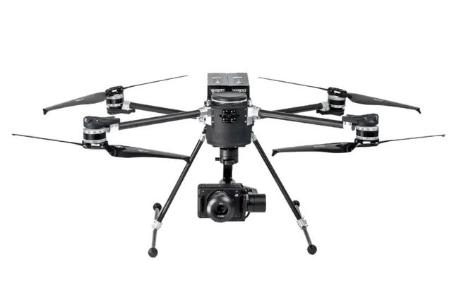
Sentinel Drone Solutions will be using the WISPR SkyScout 2+ platform on these missions.
Forged on the Front Lines of Crisis Management
Our standards aren't theoretical; they are engineered by over three decades of public safety leadership and high-risk operational experience. Sentinel’s founding framework is directly shaped by an active SWAT Sergeant, bringing unparalleled, real-world insight into tactical preparedness, agency coordination, and critical decision-making under intense pressure.
Backed by a deep academic foundation in Justice Studies and Public Administration, our leadership infuses a disciplined, standards-driven approach into every mapping asset, risk buffer, and digital twin we build. We don't just provide aerial imagery; we deliver legally compliant, ethically governed spatial intelligence designed to protect responding personnel, enterprise assets, and the communities they serve.
Precision Spatial Data Built for High-Stakes Operations
Welcome to Sentinel Drone Solutions LLC. We deliver professional drone mapping and enterprise-grade spatial intelligence engineered for the world's most complex environments. Whether you need to streamline progress tracking on an active construction site or establish uncompromising situational awareness for critical infrastructure, we provide the definitive, centimeter-accurate data required to mitigate risk, accelerate timelines, and make critical decisions with total confidence.
We bridge the gap between volatile physical spaces and actionable digital twins, ensuring your command centers and ground crews always operate from a single, unified source of truth.
Drone Mapping Solutions
Critical Infrastructure & Assets
Protect vital utilities, power grids, and hazardous industrial facilities. We provide high-fidelity structural data, thermal analysis, and predictive risk modeling to prevent operational downtime and safeguard multi-million dollar assets.
Construction & Engineering Intelligence
Drive job site efficiency from breaking ground to handover. Our high-endurance UAVs capture centimeter-accurate topographic surveys, aerial volume calculations, and automated progress mapping to keep complex projects on schedule.
Tactical Public Safety Support
Deploy our proprietary FRIM™ ecosystem to revolutionize tactical training, pre-incident planning, and disaster response. We transform complex architecture into navigable, secure digital environments for public safety agencies.
The FRIM™ Standard: First Responder Intelligence Mapping
Our flagship FRIM™ platform provides secure, highly detailed interior and exterior digital twins engineered exclusively for public safety preparedness, tactical training, and incident command awareness.
Built on a foundation of strict operational trust, FRIM™ supports strategic leadership decision-making when seconds count. We explicitly draw a hard line on privacy: our technology is designed strictly for proactive emergency preparedness, never for public surveillance or real-time civilian tracking.
- Accelerated Comprehension: Replace flat blueprints with immersive 3D structural modeling.
- Seamless Agency Coordination: Unify multi-agency response teams under a single command interface.
- Absolute Data Ownership: Maintain peace of mind with enterprise-grade security protocols and 100% client data ownership.
The FRIM™ Standard: First Responder Intelligence Mapping
- Accelerated Comprehension: Replace flat blueprints with immersive 3D structural modeling.
- Seamless Agency Coordination: Unify multi-agency response teams under a single command interface.
- Absolute Data Ownership: Maintain peace of mind with enterprise-grade security protocols and 100% client data ownership.
Our flagship FRIM™ platform provides secure, highly detailed interior and exterior digital twins engineered exclusively for public safety preparedness, tactical training, and incident command awareness.
Built on a foundation of strict operational trust, FRIM™ supports strategic leadership decision-making when seconds count. We explicitly draw a hard line on privacy: our technology is designed strictly for proactive emergency preparedness, never for public surveillance or real-time civilian tracking.